Weather Station With Tides: Why the Two Come From Different Places
A lot of people want one box that shows the weather and the tide. The trouble is that the two come from different places, and knowing where each comes from also explains why the water so often ignores the tide table.
What a weather station measures
A home weather station is a set of sensors in your yard: a thermometer, a humidity sensor, a rain gauge, a wind vane and anemometer, and a barometer. It’s good at telling you what’s happening at your house right now, but a tide is outside its reach. If it shows a forecast, that’s either the console’s own guess from the barometer’s trend or something pulled from the internet, often the National Weather Service by way of an app.
Where tides come from
NOAA publishes two kinds of tide data, and they’re easy to mix up.
Predictions are math. NOAA fits a station’s long record to 37 harmonic constituents, each a smooth wave tied to the movements of the Moon and the Sun, and adds them up. Because those movements are known far in advance, NOAA can publish predictions well ahead; its online predictions go up to two years out. Predictions exist for more than 3,000 places, many of them worked out from a nearby reference station.
Observations are measurements. NOAA’s National Water Level Observation Network has more than 200 permanent gauges on the coasts and the Great Lakes, and each one records the water level every six minutes.
On a calm day the two agree closely. When the weather turns, they don’t. (The prediction side, from datums to the rule of twelfths, is in How to Read a Tide Chart.)
Where they meet: weather moves the water
NOAA’s predictions cover the astronomical tide and leave out the day’s weather. Wind, rain, river runoff and air pressure aren’t in them, and all of them move the water.
- Wind is the big one. A steady wind blowing along a bay can hold the water a foot or two above or below the prediction. NOAA uses Baltimore as its example.
- Air pressure pushes too, more gently: about a centimeter of rise for every millibar the pressure drops, once a low has lingered long enough for the sea to respond. Wind usually matters more.
- Storm surge is the extreme case: water a storm pushes ashore on top of the normal tide. The National Hurricane Center calls the two together the storm tide, and most of the surge comes from wind.
NOAA calls the difference between what the water did and what was predicted the residual. A tide table and a fixed-schedule tide clock can’t show it; a live water level reading can. On a windy day, check the measured level as well as the table.
Coastal weather: readings versus forecasts
Weather on the water also comes in two kinds.
Current readings. Many of NOAA’s long-term water level stations carry weather sensors too: air pressure, wind, air temperature and water temperature. Farther out, the National Data Buoy Center runs more than 100 moored buoys and more than 40 coastal stations that report wind, pressure and air temperature, and the buoys add wave height. All of these tell you what’s happening now.
Forecasts. The National Weather Service writes marine forecasts for coastal waters, the Great Lakes and farther offshore. Most are updated about every six hours, and they give seas as significant wave height, which is the average of the highest third of the waves.
A backyard weather station is a third, very local source. It’s useful for your porch and not much help two miles out.
What a tide clock assumes
A mechanical tide clock’s hand goes around once every 12 hours and 25 minutes, the usual gap between high tides. That fits a coast with two similar tides a day, which describes most of the East Coast. Many places on the Gulf of Mexico get one high and one low a day, and on the West Coast the two daily highs are often quite different. A fixed dial can’t follow either pattern, and it has no way to account for wind or pressure.
What a combined screen can show
So a “weather station with tides” usually means two sources of data on one screen. Three questions tell you what a given screen is showing:
- Is the tide measured or predicted? A live water level shows the weather’s effect on the water. A prediction alone won’t.
- Is the weather a reading or a forecast? A station’s readings tell you what’s happening at the water now. A forecast tells you what’s coming.
- Whose weather is it? Your yard, the nearest NOAA station, or a forecast zone.
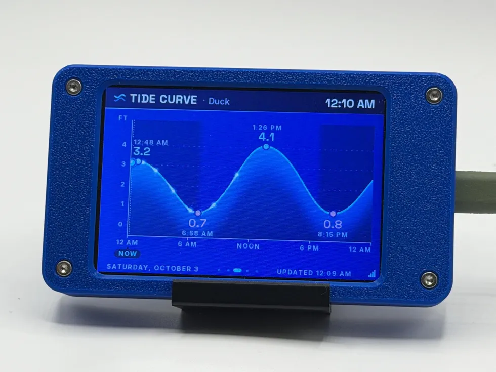
Two of the gadgets I build split along that line. Tide Station shows the measured water level where the station records one, NOAA’s predictions, and that station’s current weather readings where it reports them, with no forecast. Storm Sentinel shows National Weather Service forecasts, alerts and radar for your ZIP code, with no tides.
QUICK ANSWERS
Fair questions
Is there a weather station that shows tides?
Not in the usual sense. A home weather station measures conditions in your yard with its own sensors, and none of them can measure a tide. Tide information comes from NOAA: predictions for more than 3,000 places, and measured water levels from its tide gauges. Devices that show both, such as WiFi tide displays, pull the tide data from NOAA over the internet, and some also show the weather readings that NOAA’s own stations collect.
Why is the water higher than the tide table said?
Usually wind. NOAA’s tide predictions cover only the pull of the Moon and the Sun, not the weather. A steady wind blowing water into a bay can hold it a foot or two above the prediction, and a wind blowing it out can drop it below. Low air pressure adds a little, about a centimeter for each millibar it falls, if the low lingers. A storm surge is the extreme version.
How far ahead are tides predicted?
Years ahead. The tide follows the Moon and the Sun on a known schedule, so NOAA can publish predictions up to two years out. The predictions leave the weather out, which is why the measured water level on the day can differ.
Do NOAA tide stations report weather?
Many do. A large share of NOAA’s long-term water level stations also measure air pressure, wind, air temperature and water temperature. Those are current readings at the station, not a forecast. Coastal forecasts come from the National Weather Service’s marine forecasts.
THE GADGET THAT WATCHES THIS
Put it on your desk
MORE LAB NOTES
- How Earthquake Alerts Work: The Warning and the Report After
- How to See the ISS Tonight, Step by Step
- How to Choose a Desktop Flight Tracker: 5 Questions to Ask
- Magnitude vs. Intensity: The Two Numbers Every Earthquake Gets
- Weather Watch vs. Warning vs. Advisory: The Severity Ladder
- What Is a Starlink Train? The String of Lights, Explained
- The Board Inside (Almost) Every PlankLabs Gadget
- The Printers Behind the Shells: a Flashforge AD5X and a Bambu Lab X2D
- Arduino: The Workbench My Firmware Is Built On
- How to Read a Tide Chart (and Why Old Tide Clocks Drift)
- How the Outdoor Score Works: One Number for “Should I Be Outside?”
- What Is ADS-B? How Flight Tracking Works
- When Can You See the ISS? Visibility Windows, Explained
- Is It Your WiFi or Your ISP? How to Tell in 60 Seconds