How to Read a Tide Chart (and Why Old Tide Clocks Drift)
A tide chart is one of the oldest data products in the world — mariners have organized their days around them for centuries. But if nobody ever walked you through one, it’s just a wiggly line and some numbers. Five minutes here fixes that permanently.
What the chart actually shows
A tide chart (or table) gives you, for one specific place:
- The times of high and low water — usually the only numbers most people read.
- The predicted heights at those times, in feet.
- The curve between them — how the water level travels from one extreme to the next over roughly six hours.
The key phrase is one specific place. Tides are profoundly local: the timing and size of the tide at two harbors twenty miles apart can differ by an hour and several feet, because tides are giant slow waves interacting with coastline shape and seafloor depth. Always use the station nearest to where your hull, waders, or beach chair actually are.
The zero line is a choice (and it’s a clever one)
Those heights have to be measured from something. In the US, the reference — the chart datum — is called MLLW: Mean Lower Low Water, the long-term average of each day’s lower low tide.
Why so pessimistic? Because nautical charts state water depths from the same line. If your chart says 6 feet of water and the tide table says +2.1 feet, you have roughly 8 feet under you. Measuring from an average-low baseline means the depth on the chart is close to the least water you’d typically find — a safety margin baked into the definition. It also means an unusually low tide can go below zero: the famous negative tide, when the sea pulls back past its usual floor and reveals the neighborhood it normally keeps underwater.
One high a day, or two?
Textbooks describe two highs and two lows a day (a semidiurnal tide, like most of the US East Coast). But it’s not universal:
- Semidiurnal: two roughly-equal highs and lows daily.
- Diurnal: just one high and one low per day — common across much of the Gulf of Mexico.
- Mixed: two per day but noticeably unequal — typical of the West Coast.
This matters more than trivia: it’s one big reason a generic “tide clock” from a gift shop can be wildly wrong depending on where you live. Which brings me to the next question.
How does a tide clock work? Why mechanical ones drift
A traditional tide clock is a regular clock geared to run on a 12-hour-25-minute cycle — half a lunar day (24 h 50 m), the average rhythm of a semidiurnal tide. It’s a lovely idea with three built-in problems:
- It only models the average. Real high tides wander around that average from week to week; the pointer slowly walks away from reality until someone resets it.
- It assumes a semidiurnal coast. On diurnal or mixed shores — again, much of the Gulf — a two-tides-a-day dial is answering a question your coastline isn’t asking.
- It can’t see weather. Wind and pressure routinely move real water level by a foot or more relative to prediction. A gear train has no opinion about a north wind.
None of this makes the brass dial less charming. It just means the pointer is decoration, not data. The modern fix is to skip the simulation entirely and display what NOAA’s actual tide stations are measuring right now, alongside the official predictions. That is, not coincidentally, exactly what Tide Station, the digital WiFi tide clock I build, does.
Spring tide vs. neap tide: the Moon’s schedule
Tide range — the vertical distance between high and low — breathes on a two-week cycle:
- Spring tides (nothing to do with the season): around new and full moon, the Sun and Moon pull in line, making higher highs and lower lows. Stronger currents, too.
- Neap tides: around the quarter moons, the pulls work at right angles and everything flattens out — modest highs, mild lows, lazier water.
Fishermen track this because moving water moves bait. Boaters track it because a spring low is when the sandbar you’ve cleared forty times finally introduces itself to your propeller.
The rule of twelfths (the one trick worth memorizing)
The tide doesn’t rise at a steady rate — it starts slow, sprints through the middle, and eases into the turn. Sailors approximate it beautifully: divide the range into twelve parts, then count 1–2–3–3–2–1 across the six hours. One twelfth moves in the first hour, three twelfths in each middle hour.
Practical translation: half the water moves in the middle two hours. If you’re timing a crossing over something shallow — or wondering how fast the beach under your cooler is disappearing — the middle of the cycle is where things happen fast.
That’s the whole literacy course: know your station, know your datum, know your coast’s rhythm, respect the moon phase, and count twelfths when you’re cutting it close. The tide will still wait for no one — but at least now you’ll know exactly how long you’ve got.
QUICK ANSWERS
Fair questions
Why are the tides about 50 minutes later every day?
Tides follow the Moon, and the Moon rises about 50 minutes later each day (its ‘day’, one trip around our sky, takes 24 hours 50 minutes). The tide schedule slides along with it, which is why last Saturday’s perfect launch time is wrong this Saturday.
What is a negative tide?
A negative tide is a low tide that dips below the chart datum, the ‘zero’ line, which in the US is the average of the lower low tides (MLLW), not the lowest possible water. Negative tides expose flats and rocks you normally never see, and they’re prime time for clammers and tidepoolers.
What is a king tide?
A king tide is an informal name for the year’s most extreme tides, which happen when a new or full moon lines up with the Moon’s closest approach to Earth. Higher highs, lower lows and stronger currents: great for planning, worth respecting.
Can weather change the tide?
The astronomical tide is predictable years ahead, but weather rides on top of it: sustained onshore wind and low barometric pressure can push water noticeably higher than predicted, and offshore wind can hold it out. That’s why real-time sensor readings matter alongside predictions.
THE GADGET FOR THIS OBSESSION
Put it on your desk
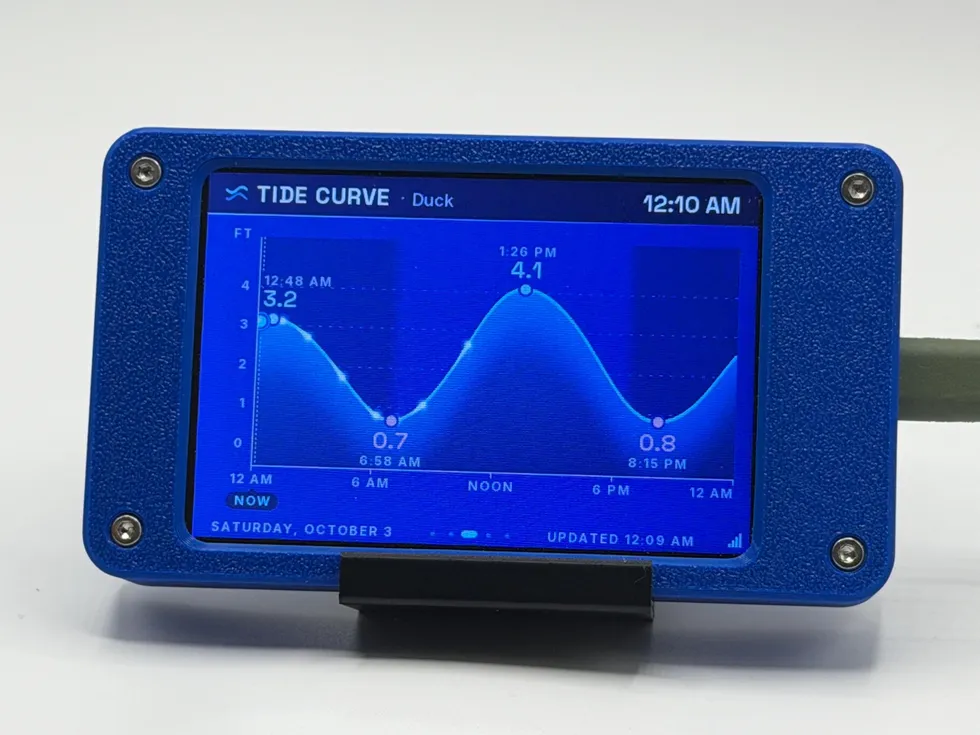
Tide Station also headlines the gift guide for boaters, fishermen & beach-house people, if you happen to be shopping for one.
MORE LAB NOTES
- How to Choose a Desktop Flight Tracker: 5 Questions to Ask
- Magnitude vs. Intensity: The Two Numbers Every Earthquake Gets
- What Is a Starlink Train? The String of Lights, Explained
- Weather Watch vs. Warning vs. Advisory: The Severity Ladder
- The Board Inside Every PlankLabs Gadget
- The Printers Behind the Shells: a Flashforge AD5X and a Bambu Lab X2D
- Arduino: The Workbench My Firmware Is Built On
- How the Outdoor Score Works: One Honest Number for “Should I Be Outside?”
- What Is ADS-B? How Flight Tracking Actually Works
- When Can You Actually See the ISS? Visibility Windows, Explained
- Is It Your WiFi or Your ISP? How to Tell in 60 Seconds